Wednesday, October 13, 2010

10-11-10 Boone County Conservation District - Tuttle Clarkson

I took today as a vacation day, thinking a month or two ago when I was forced to select vacation time that it would be cool enough for a nice hike today. As it turned out, it was quite warm, getting into the mid-80s with sunshine most of the day.  The three of us (me, wife, and beagle) took off for a conservation area (Tuttle Clarkson) in a neighboring county that we have passed by many times, but never stopped at.

There is little detailed information and no trail maps available on the their web site about their facilties, so I emailed them a couple of weeks ago and asked about trail maps and they sent me trail maps of all their facilities in the mail. It has only a short trail segment (less then 3/4 of a mile IIRC), so it was not real high on my list of places to hike, but it was getting warm and the beagle does not deal with the heat real well, so I figured it might be a good place to try today.

It was not a bad, if short hike. Mostly a grass path through the fields and marshy areas, along with some boardwalks and a lot of pretty rustic grass/dirt paths that have not seen a lawn mower in quite a while. They seem quite proud of the fields of weeds they have planted. :)

I did not bother to show the route we took on the trail map. We just followed the path from the parking lot, past the outhouse, and then to the loop.

[added 10-14-10] In case you are curious, I made the JPG of the trail map by scanning the brochure they emailed me into a PDF file, then using the snapshot tool in Adobe Acrobat reader to capture the trail map part of the brochure, pasted it into Irfanview, and then saved it as a JGP. I did the same for the other brochures they sent me, for future use.
When we got there, the lawn mower was in use. You can see the toilet facilities in the background. The picnic area is just to the right of the sign. Just a corner is visible in this picture.

I thought maybe there was something in the mailbox. Trail maps, poop bags, something. But it was empty except for a couple of earwigs.
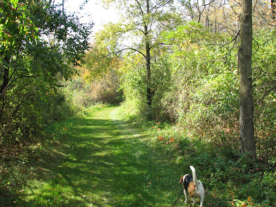
 The path starts out like this. It had just been mowed.
 A bench where the trail loop starts. We went to the right.
The first boardwalk. The mowing stopped here.
There are a series of signs along the trail, describing the different areas. This one describes where the oak trees meet the sedges. The signs are actually pretty good reading.
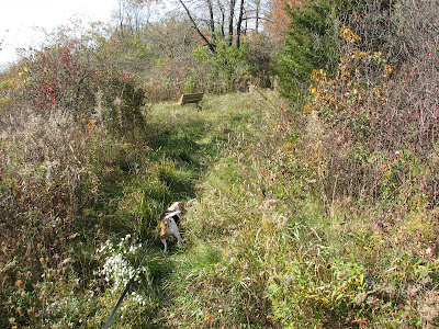
The rest of the trail looks like this. They probably only mow it once or twice a season.
 The fen.
In the background you can see a corn storage silo. The dryers were running so it was pretty noisy.
Another boardwalk.


 A small pond to the right side of the boardwalk.
Wilma decided it would be a good idea to jump off one of the boardwalks into the muck. She went under the boardwalk to investigate something there and I had the dickens of a time coaxing her out. She finally came out and jumped back up on the boardwalk. She had sunk down to her belly in the muck.

 Bridge over a very nice creek. But, alas, no access to the water for the creek beagle. There were actually two such bridges, but no safe creek access for the little critter.
 Upland woods.
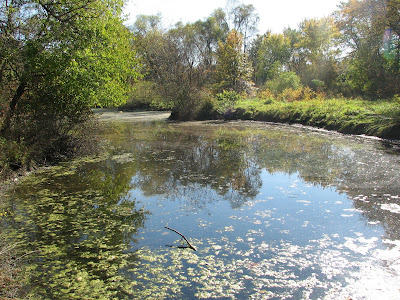
 The creek.
It was by now in the mid 80s and pretty sunny. Not much shade on the path. Wilma had to take a breather on our way back to the car.
I gave her some water out of my water bladder and she laid in some shade on the trail. I think part of the deal was cooling off by getting on the ground, and part of it was using the grass to clean the mud off. By the time she was ready to continue, she was pretty clean again. Sadly for the creek beagle, while there was a very nice looking creek, there just was not any safe access to the water for me to get her close enough to get in. It would have been good for her to cool off, get a drink, and rinse off the mud.
Good thing she got the mud off in the grass, as I never found any water source there. There is none shown on the trail map, and I didn't see any just looking around near the other facilities, so I am guessing no drinking  water. Not a big deal for a small preserve like that.

Being as it is such a short hike, and no creek access, it's not likely to be a place we go back to very often (if at all). But, it was worth going once. It is adjacent to a busy state road (route 173), so there is a fair amount of traffic noise, although it is not real distracting.

BTW, we ran across two other dogs who were also walking their humans in the preserve. It may be a popular spot for dogs to bring their humans.

Sunday, October 10, 2010

10-10-10 FP District HQ

This was different. I expected a pristine path through the woods, being as we walked at the HQ facility, but it turned out a little different. I mostly selected this location because it was warm today, and I was still a little sore from yesterday's hike, so I figured this would be a relatively easy and short hike.

As the route I drew on the trail map shows, we went a little off trail. I took the mowed trail that starts by the outhouse.
There is a set of stone steps behind this sign you can't see in the picture.
Dog poop bags provided. This is the only FP that I have run across them. Maybe because it is their HQ they want to keep it a little cleaner.
The stone steps that go down the hill behind the big sign.
We went down this mowed path that starts by the outhouse instead.
A pond at the bottom of the hill.
The trail gets pretty poorly maintained as we walk by the pond. In many places it was hard to tell where the trail was and at some point I lost the trail entirely, assuming this is the trail. I never saw a trail marker.
It's pretty open so other than typical forest debris it's not hard to go pretty much where you want to. I just went in the general direction the map showed toward the river when the trail petered out.
There is sort of a trail along the river, so I figured we had picked it up again. No markers though. Lots of debris that we had to walk around. A few old tires, barrels, and other litter, but mostly forest type debris.


This sure looks like a trail.
Sort of.
The river bank is like this in a lot of places. We were  maybe 10 feet from the river bank. But not many places where there is actual access to the water.
Detour. But look closely behind the fallen tree. There is a picnic table along the shore line, making me think it really is the trail. Or maybe it is for people on the river to pull over for a quick bite or a rest. It is about the most oddly located picnic table I have ever run across though.

We found this spot where there was access to the water. Wilma sniffed the river but refused to drink from it or play in it. A very discerning beagle.
Another detour. About this time I figured I had lost the trail completely, if I was ever on it. But with the river as a guide, and as open as the woods is there, it's real hard to get lost. Even if you are not real sure where the trail actually is.
We emerge from the woods along the river at the far north edge of the FP along the river and find this field. At first I thought this building was part of the FP HQ complex, but I eventually decided it is a private residence. I never saw any property line markers indicating the FP property ended until I walked along the property line for maybe 100 yards. So we went back and re-entered the woods after consulting the map and followed the property line markers inside the woods


We find what appears to be a trail again.
A boardwalk out in the woods. A bit ramshackle looking. Maybe the area is waterlogged at certain times of the year. I saw no evidence that anyone had been in this area in quite some time. No foot prints, and the trail (if I was ever on it) appears to have very sparse use.
But we walked on it. It is sturdy, if uneven, and a few boards have popped their nails.

A short dirt trail at the end of the boardwalk leads to the stone steps.
We start on the bike path.

No idea who Polly Berg is. Probably some local politico.
I guess they are real serious about dogs in this FP. There were a bunch of these signs up.
A nice view of the quarry lake.
No fishing, but a path that leads to the north side of the quarry.
It's pretty much a sheer wall with maybe 50 to 100 foot drop offs all the way around the quarry.

Some kind of unofficial path I guess.
Benches are conveniently located along the bike path.


No fishing, no camping, no swimming. The sheerness of the walls and the height make it unsafe to get close enough to fish, so I can understand why they don't permit fishing there.
I can't say I have ever seen a sign like this on FP properties anywhere else.
I estimate about 1.75 miles total, but it took us an hour and 15 minutes. The bike path is a normal bike path with some nice views of the quarry, but the woods is a neat walk. Lots of forest debris, and pretty muddy, even where there was a trail. I am still not real sure if we ever were on the official trail at all. But there was never any danger of getting lost, and it was kind of neat exploring. Despite the short length of the hike, and the small area, the wooded area there is a bit of a gem.