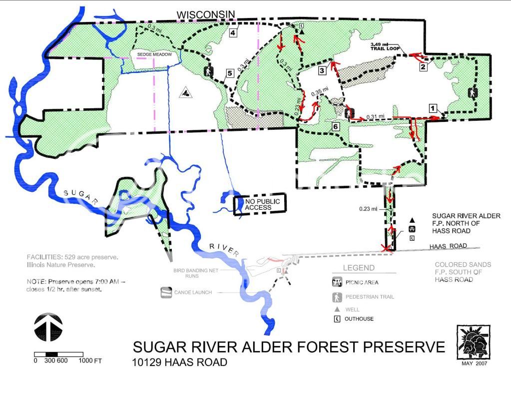
A nice hike if a bit of a workout due to the conditions. A lot of the trails are packed in snow and I was sinking into it, making it tough and slow going for some trail sections. I wanted to take the whole main loop but the segment that goes along the far northern part of the park headed west is all but snowed under. Just was not going to happen without snow shoes.
I wanted to explore in the far north west corner of the park. I have been told it is possible to get from this preserve into the Avon Bottoms area in Rock County in WI. They do seem to abut each other so it might be possible, but I would need to get closer to the river than the existing conditions allowed for.
We ended up doing 3.25 miles according to GPS in just over 3 hours. Has to be the longest 3.25 miles I ever walked.
I don't remember seeing any of the numbered trail markers that the trail map promises, but there were trail maps posted at just about every trail intersection we came across.
We ran across 5 people and 5 dogs while we were there.
[3-7-11] I emailed the WI DNR as to whether it is possible to get across the state line from this preserve on Feb 28, and got this response back this morning.
Yes it is possible (though as you discovered not always easy) to hike across the stateline from far NW corner of the Sugar River Alder Forest Preserve in Illinois to the Avon Bottoms State Wildlife Area in Wisconsin. I have done it going from north to south under frozen conditions in the winter, and I imagine you could do so by wading sloughs and backwaters at other times of year. There are no trails to my knowledge. Once you get in there, the only places to exit through public land are via St. Lawrence Road, Brandherm Road, or Nelson Road, going south to north. You can see maps at http://dnrmaps.wi.gov/DNRManagedLands/index.htm?propname=AVON%20BOTTOMS%20WILDLIFE%20AREA
It is quite remote, but well worth the effort if you like to get away from it all. A compass or GPS is a good idea, as it is quite easy to get turned around in there.
Sunday, February 27, 2011
Saturday, February 26, 2011
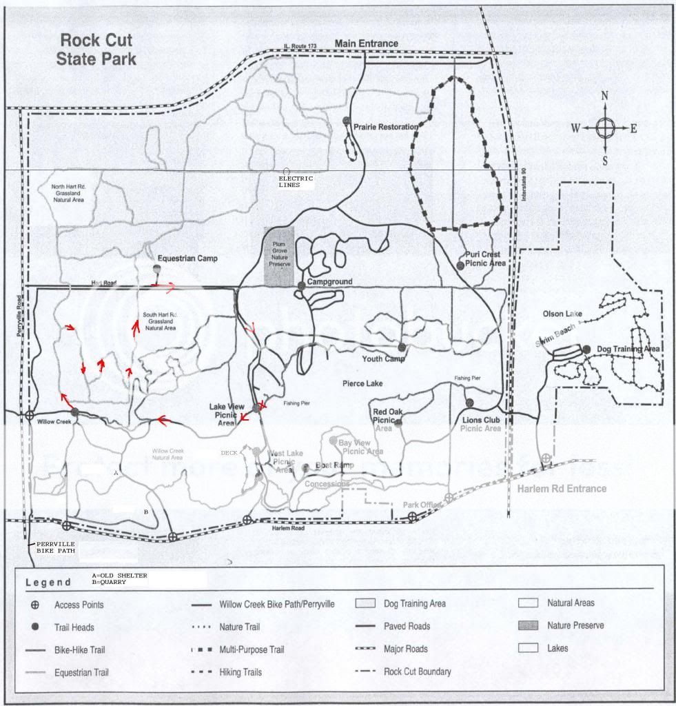
Rock Cut State Park 2-26-11
I am not sure how accurate this route is. Lots of trails in the horse area that are not on the trail map. In a general way, it is pretty close.
3.46 miles according to my GPS. 2 hours and 11 minutes. I tested what the GPS showed versus the car odometer by driving back along the final segment. Both reported about 0.6 miles. I don't believe what the GPS reports for moving and stopped times, although the total time seems correct. I don't know how it calculates stopped time but it seems to report a lot more time as "stopped" then really happened.
It turns out they are serious about the park closing at 5 pm and not getting locked in. I went out toward the route 173 gate. At 5:03 pm I met the park guy coming back on the road who waved me down and said the gate was already closed and I would have to go out through the Harlem Road exit.
3.46 miles according to my GPS. 2 hours and 11 minutes. I tested what the GPS showed versus the car odometer by driving back along the final segment. Both reported about 0.6 miles. I don't believe what the GPS reports for moving and stopped times, although the total time seems correct. I don't know how it calculates stopped time but it seems to report a lot more time as "stopped" then really happened.
It turns out they are serious about the park closing at 5 pm and not getting locked in. I went out toward the route 173 gate. At 5:03 pm I met the park guy coming back on the road who waved me down and said the gate was already closed and I would have to go out through the Harlem Road exit.
Subscribe to:
Posts (Atom)