I have decided to just make the trail map part of the video. It's just simpler that way. It's kind of time consuming stitching these video snippets together and having to upload a JPG to photobucket and then link to it is extra work. If there is some special reason to have an image separately, I will, such as if it needs to be high resolution.
Thursday, November 25, 2010
Wednesday, November 24, 2010
rock cut state park 11-24-10
I was planning to hike a bit longer but it started to sprinkle on us, so we went back to the car.

It started raining on us while we were out on the trail so I got the orange poncho out of its baggie and put it on. It worked about as well as I expected. It kept the top half of me and my day pack dry. It was not raining real hard so it was not the most stringent of tests.
The hood tore because it was too small to go over my cap. It just barely goes over my head. I guess the hat will have to go over the hood. I also experienced a small tear along one side, and a longer tear on the same side. Neither of these tears ended up being an issue.
My sleeves got wet, but not to the point that it soaked through the nylon. It would have been more of an issue if it had been raining harder, or windier, or I was out in the rain longer.
Overall, I rate it adequate to get me back to the car from out on the trail a mile or so out without getting excessively wet.
It did strengthen my desire to get a real poncho though. This is just not adequate for anything serious.
I taped it back together in case I need it again and have not yet acquired a real poncho.
Sunday, November 21, 2010
Hiking stick fail
update to
I guess I will go back to a spade handle. It sounded like a good idea at the time to have a stick that could be taken down, but it was just not as sturdy. I got some good use out of it, but I am real glad it did not fail at a more inopportune time, like when I was half way up or down some steep trail section.
I guess I will go back to a spade handle. It sounded like a good idea at the time to have a stick that could be taken down, but it was just not as sturdy. I got some good use out of it, but I am real glad it did not fail at a more inopportune time, like when I was half way up or down some steep trail section.
Rock Cut State Park 11-21-10
Today's hike was at Rock Cut State Park.
I suspect most of the trails we were on are not on the map. We entered the SW quadrant of the park from the observation deck and headed through the forest generally southwest, went almost all the way to the far SW corner of the park, then went back north to the Willow Creek Bike Path and headed east to lake View.
I am not real sure that I placed the quarry or the old shelter on the trail map in the right spot, but I think this is about where they are.
Saturday, November 20, 2010
Nesco food dehydrator
I decided to give it a test with some frozen broccoli and cauliflower.
The results were not ideal, but might be adequate for making backpacking food.
Perhaps I dried them too much, but I could not get them to rehydrate even close to the amount of water that was driven off. Even so the rehydrated veggies were edible.
I did not show it in the video or pictures but I put a meat thermometer inside the thing. It showed the temperature where the probe was at was about 150 degrees F.
Kinnikinnick Creek 11-20-10
ETA: Our previous visit
Today we went to Boone county to the Kinnikinnic Creek conservation area to hike the horse trail.
I wanted to hike another trail there that I am told is especially nice but is not shown on the trail map. Despite not being on the trail map there actually is a trail head sign for it. I wonder why it is not shown on the trail map. I am told the trail goes for about 3/4 of a mile and then just stops and you either have to bushwhack it for a couple hundred yards or turn around and go back. In any case, it got too late to try that trail. It will be something for another day.
We started at the horse parking area and followed the horse trail around the perimeter of the park in a CCW direction. It took us just over 2.5 hours to hike the 3.5 miles. Lots of elevation changes. It's almost constantly going either up or down. But I like that kind of hiking. I am not there to go as far as I can as fast as I can. Just out to get some exercise, fresh air, and some time to clear my head out.
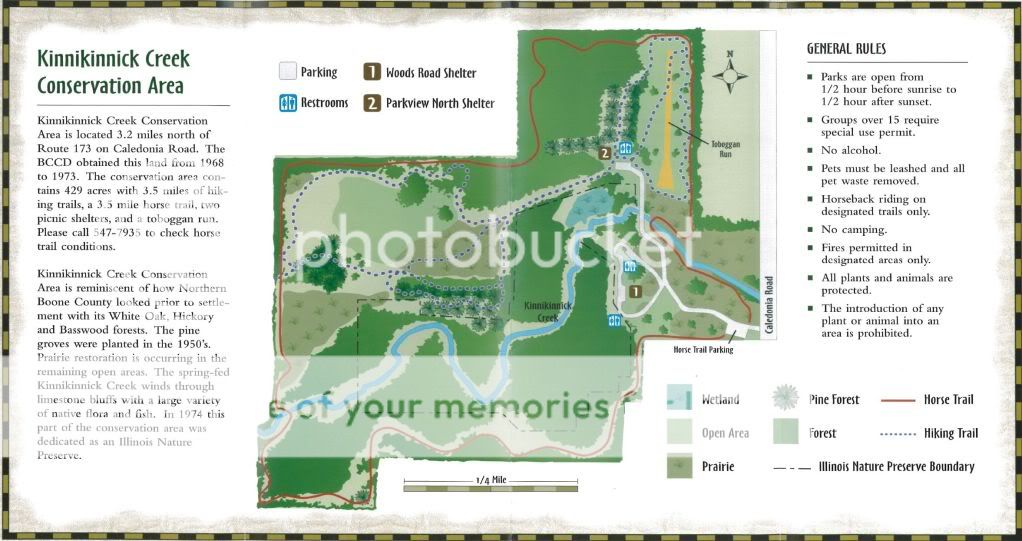
BTW, I told my wife about the dog we saw running in the park. She said she saw a dog wearing an orange coat in a car leaving the park with two guys who had orange hats on. So, I guess the dog found his humans, or maybe the humans were just farther down the hiking trail where I could not see them.
Today we went to Boone county to the Kinnikinnic Creek conservation area to hike the horse trail.
I wanted to hike another trail there that I am told is especially nice but is not shown on the trail map. Despite not being on the trail map there actually is a trail head sign for it. I wonder why it is not shown on the trail map. I am told the trail goes for about 3/4 of a mile and then just stops and you either have to bushwhack it for a couple hundred yards or turn around and go back. In any case, it got too late to try that trail. It will be something for another day.
We started at the horse parking area and followed the horse trail around the perimeter of the park in a CCW direction. It took us just over 2.5 hours to hike the 3.5 miles. Lots of elevation changes. It's almost constantly going either up or down. But I like that kind of hiking. I am not there to go as far as I can as fast as I can. Just out to get some exercise, fresh air, and some time to clear my head out.
BTW, I told my wife about the dog we saw running in the park. She said she saw a dog wearing an orange coat in a car leaving the park with two guys who had orange hats on. So, I guess the dog found his humans, or maybe the humans were just farther down the hiking trail where I could not see them.
Sunday, November 14, 2010
Sugar River FP 11-14-10
It was kind of windy and cool when we started, but it is mid-November. Somehow I screwed up getting video of some deer and a great blue heron. I thought I had them both, but I guess I got too excited or something. Maybe I forgot to press the record button a second time to save the recording before I shut the camera off.
It was somewhere around 3.5 miles long.
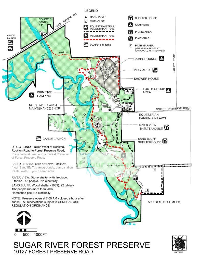
It was somewhere around 3.5 miles long.
Saturday, November 13, 2010
Rock Cut State Park 11-7-10
I have to apologize for the poor quality video. I am new at this.
I also screwed up some of the subtitles.
This is more or less the route we took. We went west along the creek in the SW quadrant of the park starting near the deck, and then turned south and west. It does not appear that most of the trails we were on are even on the map. I doubt the little red line I drew accurately depicts our route, other than in a very general way.
It was probably about a 2.5 mile hike.
Wednesday, November 10, 2010
Seward Bluff Forest Preserve 11-6-10
This was a pretty good hike. I decided to use video instead of just still pictures to document our little adventure this time. I ended up with about 18 minutes of video. Unfortunately, I only had about 15 minutes available on the SD card I took with me, and I did not take a spare, so the last two clips were taken after the fact.
I am guessing the hike was a little over 5 miles long. My cell phone pedometer and the trail map both seem to support that idea.
Basically we started at the Grove Creek shelter and headed downstream (west) along the south side of the creek until the creek turned north. We followed the creek until we found the foot bridge. Then we came back along the other side of the creek.
Be advised - I seemed to be confused about what direction things were a couple of times. I realized after watching the video what I said sometimes was not really the direction I was going or something was headed. Part of the issue is the trail meanders around a lot and you can basically be going west on a trail but at any one moment in time it might be any direction. There are also a fair number of trails not shown on the trail map so it's hard to follow along the trail map while listening to the narration.
We went a little north up to the horse parking area, and then back to the road.
I am sorry for some of the poor narration. It's my first shot at this kind of thing. I will try to be more aware of some things like not saying "well" so much.
In case anyone is interested, I tried stitching the 50+ little snippets of video together with Windows Movie Maker. It was quite easy to do and the result played quite well inside Movie Maker. Alas, like many MS products, it came with a catch. No matter what, it just would not save the stitiched together movie. It would try but just crash or tell me it was out of memory. After much frustration I gave up on Movie Maker. I found something that is just as easy, is also freeware, and actually worked. It's called VideoPad.
There is at least one mistake in the narration that I noticed. In the first clip I said the trail head is not where it is shown on the map. It actually is. I was reading the map wrong. In fairness to me the map was a little confusing, but that's not really a good excuse, just an average excuse.
I sent an email to the FPD asking about the numbered sign posts. they replied saying that trail maps with the sign posts noted are available at the entrance and the horse parking area. I did not see them either place, but I never actually looked for them either. Next time I will snag one. In the meantime, I added some stuff to the trail map I got off their web site. But don't bet your life on what I marked on the trail map.

[sign pic added 11-13-10]

[11-13-10 fixed embedding]
I am guessing the hike was a little over 5 miles long. My cell phone pedometer and the trail map both seem to support that idea.
Basically we started at the Grove Creek shelter and headed downstream (west) along the south side of the creek until the creek turned north. We followed the creek until we found the foot bridge. Then we came back along the other side of the creek.
Be advised - I seemed to be confused about what direction things were a couple of times. I realized after watching the video what I said sometimes was not really the direction I was going or something was headed. Part of the issue is the trail meanders around a lot and you can basically be going west on a trail but at any one moment in time it might be any direction. There are also a fair number of trails not shown on the trail map so it's hard to follow along the trail map while listening to the narration.
We went a little north up to the horse parking area, and then back to the road.
I am sorry for some of the poor narration. It's my first shot at this kind of thing. I will try to be more aware of some things like not saying "well" so much.
In case anyone is interested, I tried stitching the 50+ little snippets of video together with Windows Movie Maker. It was quite easy to do and the result played quite well inside Movie Maker. Alas, like many MS products, it came with a catch. No matter what, it just would not save the stitiched together movie. It would try but just crash or tell me it was out of memory. After much frustration I gave up on Movie Maker. I found something that is just as easy, is also freeware, and actually worked. It's called VideoPad.
There is at least one mistake in the narration that I noticed. In the first clip I said the trail head is not where it is shown on the map. It actually is. I was reading the map wrong. In fairness to me the map was a little confusing, but that's not really a good excuse, just an average excuse.
I sent an email to the FPD asking about the numbered sign posts. they replied saying that trail maps with the sign posts noted are available at the entrance and the horse parking area. I did not see them either place, but I never actually looked for them either. Next time I will snag one. In the meantime, I added some stuff to the trail map I got off their web site. But don't bet your life on what I marked on the trail map.
[sign pic added 11-13-10]
[11-13-10 fixed embedding]
Tuesday, November 2, 2010
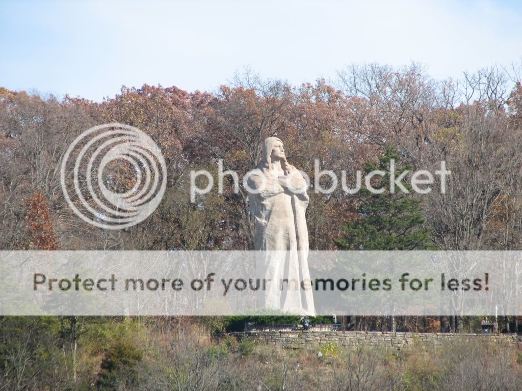
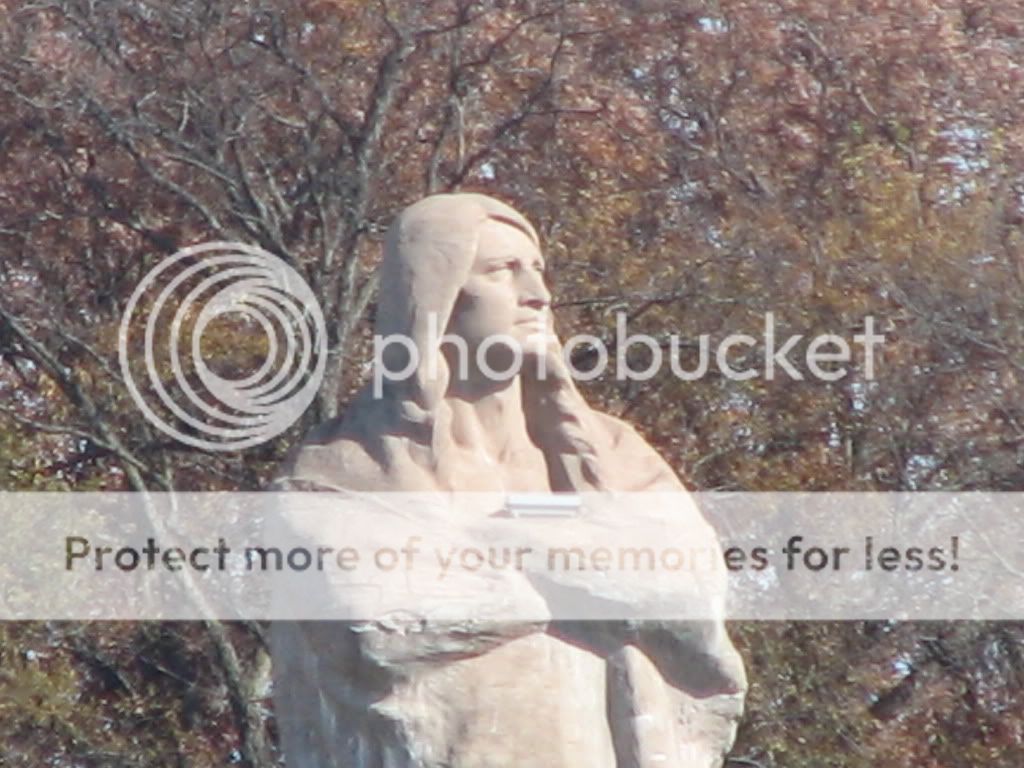
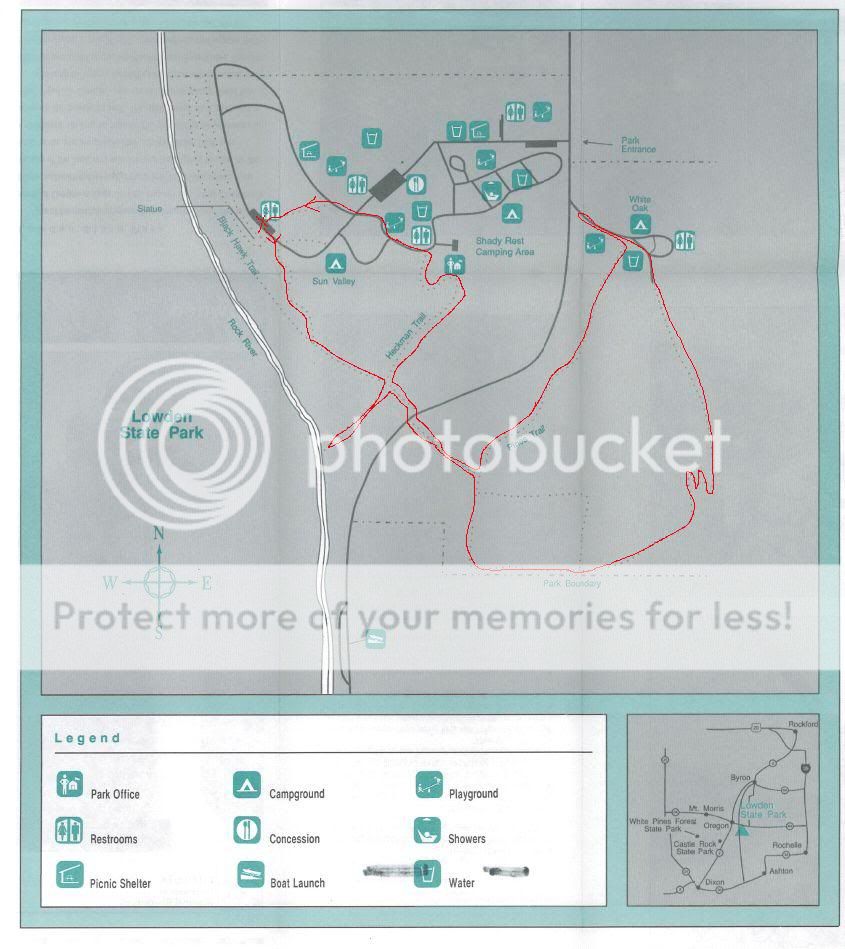
Lowden State Park 10-31-10
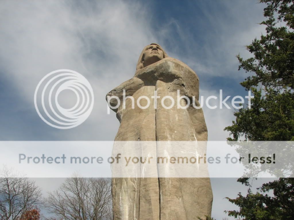
Lowden is a state park along the Rock River near Oregon, IL. It's claim to fame is the statue of Blackhawk on the side of a mountain. This is Blackhawk as seen from the other side of the river.
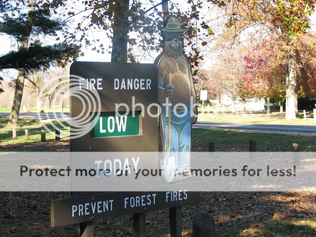
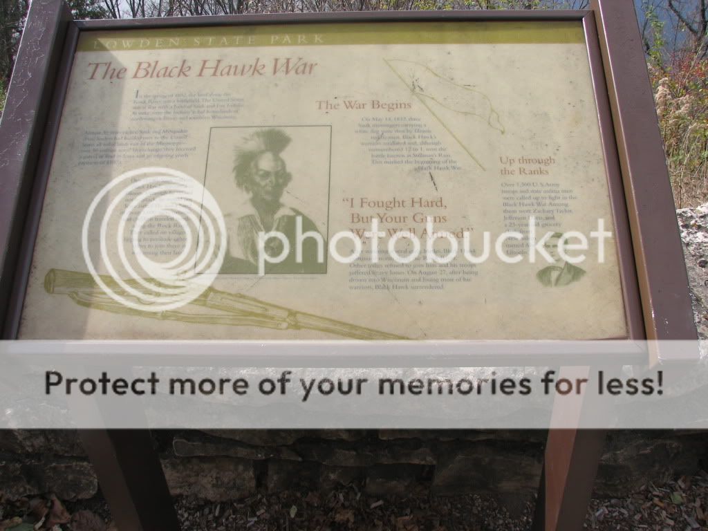
The signs at the park entrance.

We parked near the statue and took a few pictures of the statue and some of the signs in the area first.


The view of the Rock River from beneath the statue.

The roof of the outhouse by the statue was damaged in a storm 3 months ago and not repaired yet. Maybe a victim of the current financial disaster the state is in. I emailed the park superintendant and asked about it and he replied they are hoping to have it repaired by this spring. My wife said the women's side (under the damage) is locked, so women have to use the men's side.

We started out by going down the hill to the river level. There are two ways to get there. A trail made mostly of old railroad ties, or a staircase.

I chose the trail. It's not the greatest trail, and is pretty steep and somewhat overgrown, but it is passable.

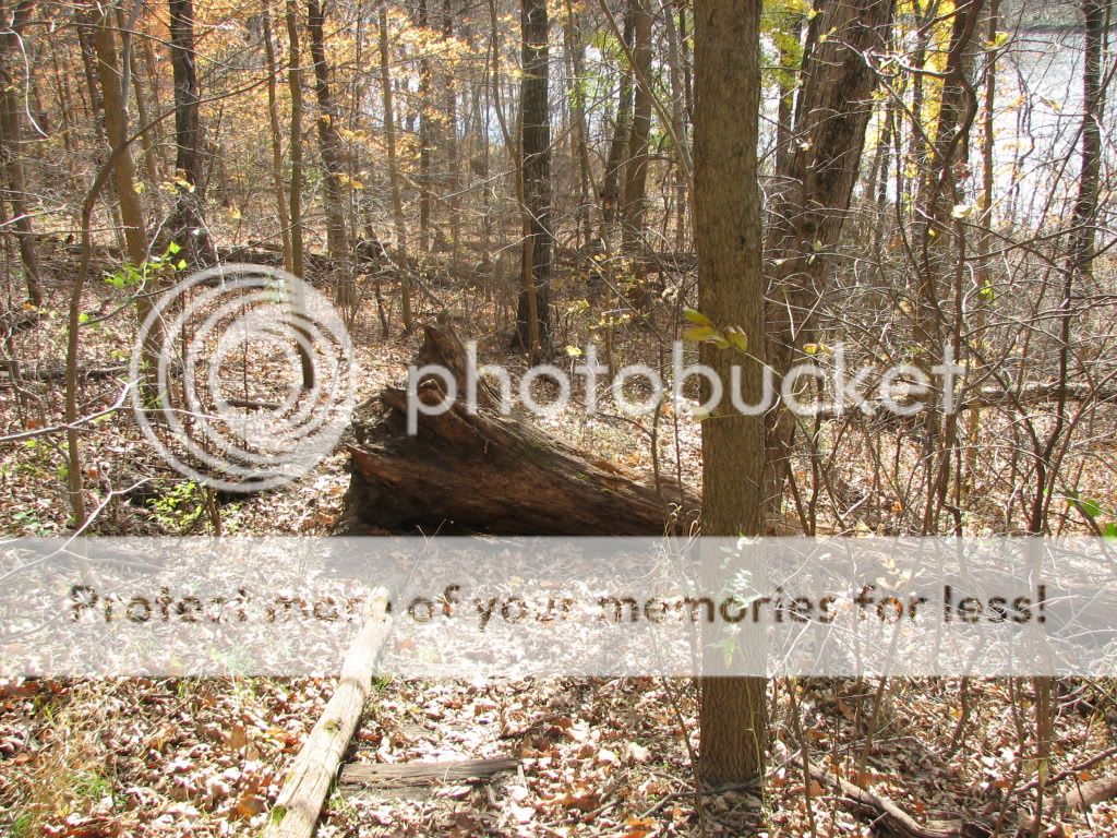
This tree has fallen across the trail but it is possible to walk around it on the left hand side.
The trail becomes nice and level along the river headed south.

The sign where the Heckman and Blackhawk trails cross.

It's only maybe 100 yards down the Heckman trail to the river so we headed that way. Someone had a fire there not too long ago.

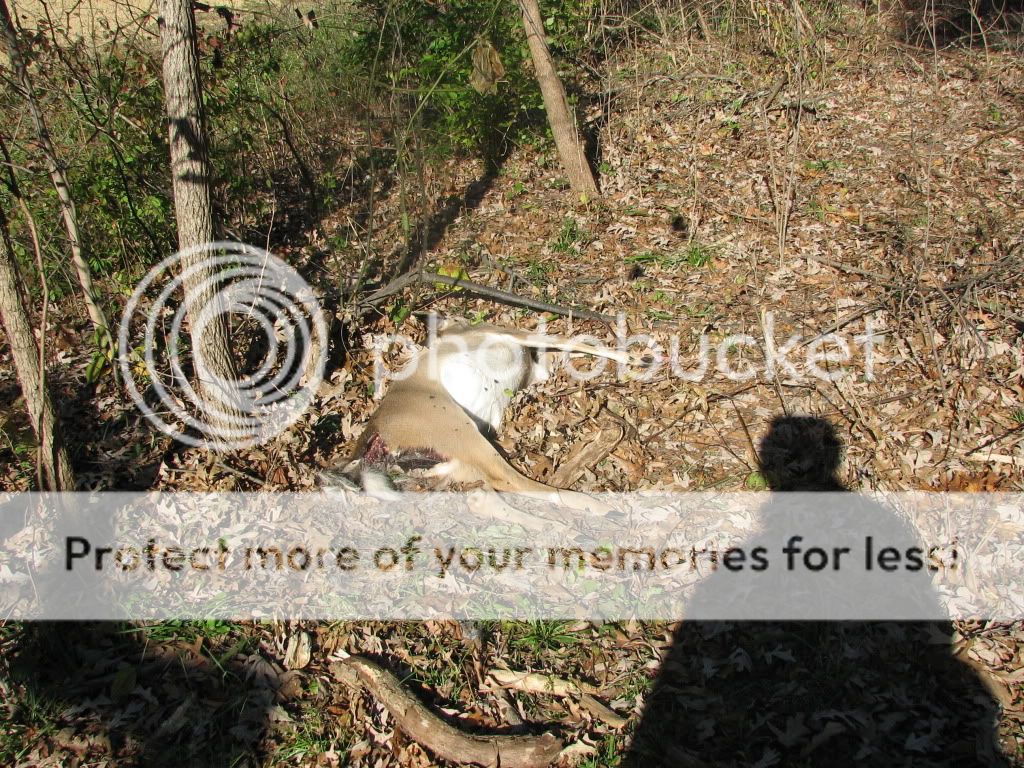
We continued along the Blackhawk trail to the road that bisects the park (north/south) and continued to the east side of the park on Pine Trail. We saw this deer carcass just inside the shrubs along the road at the entrance of Pine Trail. I emailed the park superintendent about it the next day and he said he would alert the DOT. You can't see it from the road, and it looked like it might have been there a few days.
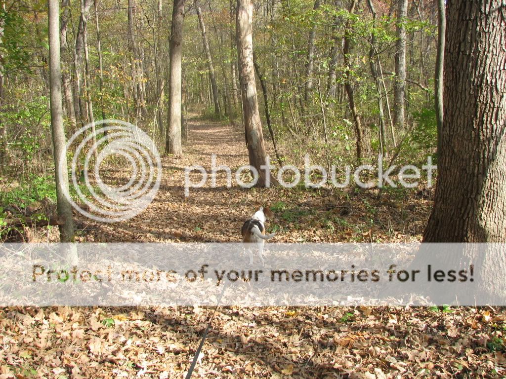
Pine Trail starts out as a nice grassy and level lane along the edge of the pine woods. There are farm fields about 20 feet to the right and pine trees to the left.

The trail goes into the forest and becomes a kind of typical forest trail.
It starts to go uphill. There is perhaps a 200 yard stretch of it that is relatively difficult with switchbacks and pretty steep climbing. Glad for my stick. I did not take pictures of the worst of it as I was too busy trying to keep my self going up the hill. This picture is of a relatively easy part of the hill.

The worst of it did not last long and we came out into the primitive camping area. A black lab and his human came up from behind us. They were RUNNING on the trail. Wilma got a drink from a hydrant in the area.

I did something as well. I did not need to heed this particular sign, but having spent some time in Mexico a few years back, I can understand the need for it.

Wilma and I went went down the road toward the entrance on River Road and then came back to catch the trail again.
This is pretty typical of the route coming back on this side of the trail. It's not real steep, but there is quite a bit of grade change. The drop off to the left is maybe 75 feet. But it is a pretty wide trail, perhaps 10 feet or more.

We finish hiking Pine Trail and go across River Road again and head up Heckman Trail. Up is the operative word. It's 0.3 miles long according to a sign I saw, and it's up the whole way - 10-30 degree slopes. It's a gravel trail so it is not real hard to walk on or anything, but it is still up hill.

The top of Heckman Trail is near the other campground. Only a few campers. Wilma went to get some more water and then we walked back to the statue.

A nice hike. Right at 2 hours. I would guess a little over 3 miles. The park brochure says there are almost 4 miles of trails and we hiked most of them.
The signs at the park entrance.
We parked near the statue and took a few pictures of the statue and some of the signs in the area first.
The view of the Rock River from beneath the statue.
The roof of the outhouse by the statue was damaged in a storm 3 months ago and not repaired yet. Maybe a victim of the current financial disaster the state is in. I emailed the park superintendant and asked about it and he replied they are hoping to have it repaired by this spring. My wife said the women's side (under the damage) is locked, so women have to use the men's side.
We started out by going down the hill to the river level. There are two ways to get there. A trail made mostly of old railroad ties, or a staircase.
I chose the trail. It's not the greatest trail, and is pretty steep and somewhat overgrown, but it is passable.
This tree has fallen across the trail but it is possible to walk around it on the left hand side.
The trail becomes nice and level along the river headed south.
The sign where the Heckman and Blackhawk trails cross.
It's only maybe 100 yards down the Heckman trail to the river so we headed that way. Someone had a fire there not too long ago.
We continued along the Blackhawk trail to the road that bisects the park (north/south) and continued to the east side of the park on Pine Trail. We saw this deer carcass just inside the shrubs along the road at the entrance of Pine Trail. I emailed the park superintendent about it the next day and he said he would alert the DOT. You can't see it from the road, and it looked like it might have been there a few days.
Pine Trail starts out as a nice grassy and level lane along the edge of the pine woods. There are farm fields about 20 feet to the right and pine trees to the left.
The trail goes into the forest and becomes a kind of typical forest trail.
It starts to go uphill. There is perhaps a 200 yard stretch of it that is relatively difficult with switchbacks and pretty steep climbing. Glad for my stick. I did not take pictures of the worst of it as I was too busy trying to keep my self going up the hill. This picture is of a relatively easy part of the hill.
The worst of it did not last long and we came out into the primitive camping area. A black lab and his human came up from behind us. They were RUNNING on the trail. Wilma got a drink from a hydrant in the area.
I did something as well. I did not need to heed this particular sign, but having spent some time in Mexico a few years back, I can understand the need for it.
Wilma and I went went down the road toward the entrance on River Road and then came back to catch the trail again.
This is pretty typical of the route coming back on this side of the trail. It's not real steep, but there is quite a bit of grade change. The drop off to the left is maybe 75 feet. But it is a pretty wide trail, perhaps 10 feet or more.
We finish hiking Pine Trail and go across River Road again and head up Heckman Trail. Up is the operative word. It's 0.3 miles long according to a sign I saw, and it's up the whole way - 10-30 degree slopes. It's a gravel trail so it is not real hard to walk on or anything, but it is still up hill.
The top of Heckman Trail is near the other campground. Only a few campers. Wilma went to get some more water and then we walked back to the statue.
A nice hike. Right at 2 hours. I would guess a little over 3 miles. The park brochure says there are almost 4 miles of trails and we hiked most of them.
Subscribe to:
Posts (Atom)