Sunday, February 27, 2011

Sugar River Alder Forest Preserve 2-27-11

A nice hike if a bit of a workout due to the conditions. A lot of the trails are packed in snow and I was sinking into it, making it tough and slow going for some trail sections. I wanted to take the whole main loop but the segment that goes along the far northern part of the park headed west is all but snowed under. Just was not going to happen without snow shoes.

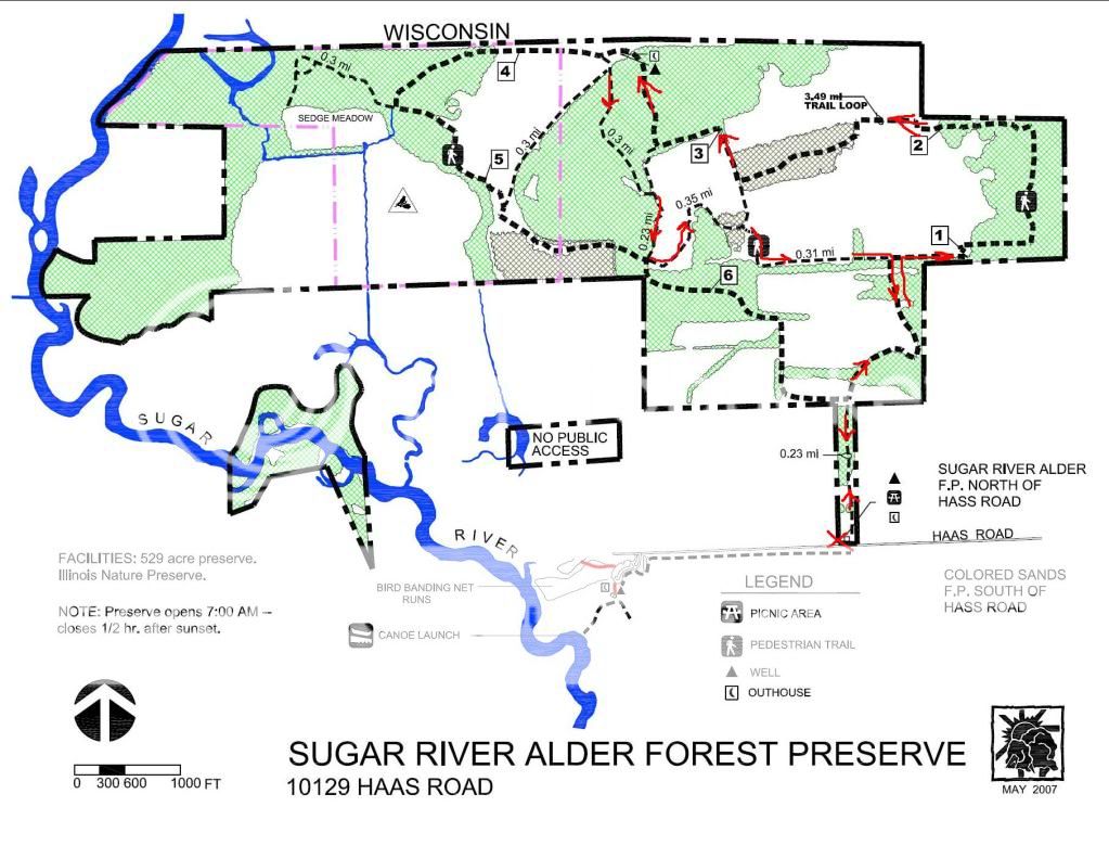
I wanted to explore in the far north west corner of the park. I have been told it is possible to get from this preserve into the Avon Bottoms area in Rock County in WI. They do seem to abut each other so it might be possible, but I would need to get closer to the river than the existing conditions allowed for.

We ended up doing 3.25 miles according to GPS in just over 3 hours. Has to be the longest 3.25 miles I ever walked.

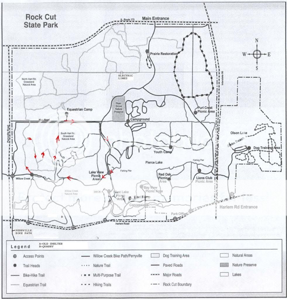
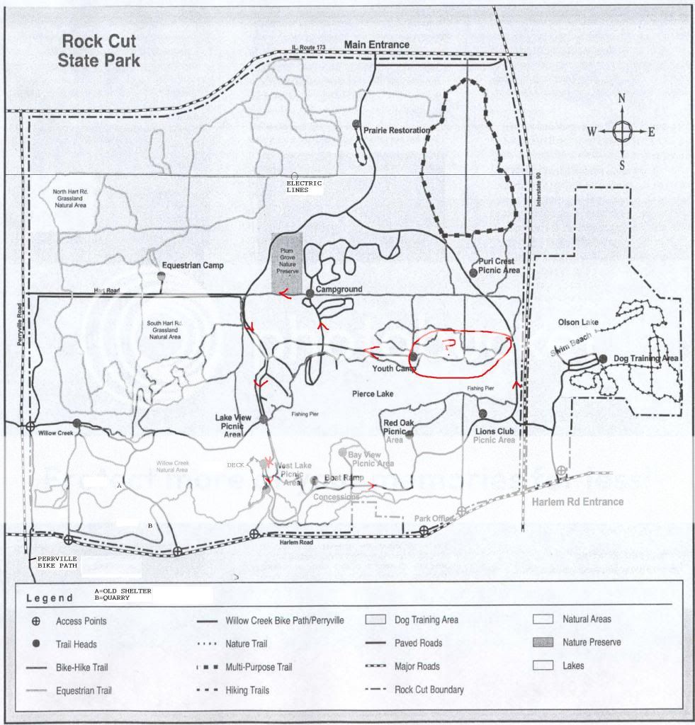
I don't remember seeing any of the numbered trail markers that the trail map promises, but there were trail maps posted at just about every trail intersection we came across.

We ran across 5 people and 5 dogs while we were there.


[3-7-11] I emailed the WI DNR as to whether it is possible to get across the state line from this preserve on Feb 28, and got this response back this morning.

Yes it is possible (though as you discovered not always easy) to hike across the stateline from far NW corner of the Sugar River Alder Forest Preserve in Illinois to the Avon Bottoms State Wildlife Area in Wisconsin. I have done it going from north to south under frozen conditions in the winter, and I imagine you could do so by wading sloughs and backwaters at other times of year. There are no trails to my knowledge. Once you get in there, the only places to exit through public land are via St. Lawrence Road, Brandherm Road, or Nelson Road, going south to north. You can see maps at http://dnrmaps.wi.gov/DNRManagedLands/index.htm?propname=AVON%20BOTTOMS%20WILDLIFE%20AREA


It is quite remote, but well worth the effort if you like to get away from it all. A compass or GPS is a good idea, as it is quite easy to get turned around in there.

Saturday, February 26, 2011

Rock Cut State Park 2-26-11

I am not sure how accurate this route is. Lots of trails in the horse area that are not on the trail map. In a general way, it is pretty close.

3.46 miles according to my GPS. 2 hours and 11 minutes. I tested what the GPS showed versus the car odometer by driving back along the final segment. Both reported about 0.6 miles. I don't believe what the GPS reports for moving and stopped times, although the total time seems correct. I don't know how it calculates stopped time but it seems to report a lot more time as "stopped" then really happened.

It turns out they are serious about the park closing at 5 pm and not getting locked in. I went out toward the route 173 gate. At 5:03 pm I met the park guy coming back on the road who waved me down and said the gate was already closed and I would have to go out through the Harlem Road exit.


OTC meds in my FAK

I don't have a whole lot. All generics. Aspirin, ibuprofen, diphenhydramine (an antihistamine), an anti-diarrheal (generic equivalent of immodium AD), and some generic pepto bismal tablets.

I have a couple small FAKs. one in my day pack, and another in my lunch bag. The meds in my day pack reside in a largish prescription bottle. The ones in my lunch bag in a small plastic envelope that snaps shut.

All the pills are in little zip lock bags except the AD that came sealed in foil.

I am pleased to report that my last box of AD expired over a year ago, not that an arbitary date like that matters much, without so much as a single pill being used. :)


I replaced the old stuff with all new. The little post it notes are so I don't forget what is in the bag or the expiration date.

I rarely if ever use the drugs from my FAKs. Just don't need them, or there are other sources for them readily available.

Wednesday, February 16, 2011

Sunday, February 13, 2011

rock cut state park 2-13-11

It was nice out so Wilma and I went for a hike in the park. It was a lot more work than normal. Quite a bit of our hike was on packed snow that was melting, so made for tough going. Glad for boots with some decent ankle support and my hiking stick.

Wilma did not seem to care much about the melting snow. She was having too much fun.

We parked by the dam and basicly walked around the lake in a CCW direction.

GPS said 3.77 miles, 1:06 moving and 2:04 stopped. I believe the total time. I don't believe the split between moving and stopped. Not sure how it determines that. I am not real sure about the distance either. We walked CCW around the lake back in October. I think I figured from the map it was close to 5 miles, and today we may have gone a little farther, as we were a little farther from the lake. Maybe I overguessed the distance back in October.

We followed along roads for most of the hike, sometimes walking on the roads, sometimes on trails along side the road. The part I circled with the question mark does not appear to have the trails we followed on the map. Somehow we got from the creek on the east side of the park to the youth camping area through the forest.


On the last leg of our trek, we ran across a man and woman walking a couple of labs. The man asked if we ever walked at Blackhawk Springs FP. I answered that we had - once. He said he thought he remembered seeing us there. I guess a fat guy with a beagle is memorable for some reason.

Also on the last leg of our trek, I drank the last of the water out of my water bladder. That would be 3 quarts in three hours. Even though it was cool, hydration is important.

Sunday, February 6, 2011

Wednesday, February 2, 2011

digging out 2-2-11


[added 2/6/11]
It cost just over $50 to get the snowblower fixed. The receipt just says replaced axle key. It may have fallen out and gotten lost when I took the wheel off. It snowed some last night so I will test it today.

Tuesday, February 1, 2011