Tuesday, September 28, 2010

Pecatonica Wetlands Forest Preserve Sunday 9-26-10

This is where I had planned to hike Saturday but the weather changed my mind. It appeared from the fresh mud puddles that it had indeed rained there Saturday, so I guess it was a good decision to head elsewhere.

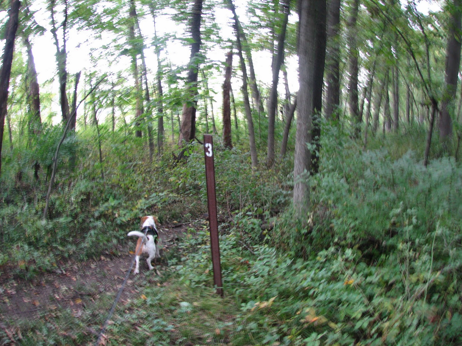
Pretty good hike. Lot's of water, birds, wild flowers, and butterflies, but not all that much access to the water for the creek beagle, but she still had a good time. About 5 and a half miles according to the map and my pedometer. About 3 hours and 40 minutes. I lost some time doing some unproductive bush whacking, and took a couple of short breaks at some conveniently located benches. I was pretty tired afterward, but Wilma was still raring to go.

I was planning to follow the main trail in a loop, however, shortly after trail marker 4, the trail just ends. The trail map shows a trail segment continuing east along Blair Rd, but there is no trail. There is what may be the remnants of a trail, but no trail.

I backtracked and went around and came up on the other side (marker 6), and it too just stops at the road. The section of trail going east/west shown on the trail map that is roughly between marker 4 and 5 just does not exist.

It would not have been so bad to walk along the road, but there are locked gates and a fence making access to the road difficult. I ran across a couple hiking in the preserve and in talking with them mentioned the missing section of trail. They said they have been hiking there for several years and they have not seen that trail segment. They just climb over the gates and walk along the road.

To me, it seems like all but forcing people to climb over a gate is just asking for someone to get hurt. Maybe a revision to the map is in order, removing the non-existent trail segment, and indicating there is no access to the road. Or some way to more easily get past the gates. I sent an email to the FP district Sunday evening, but as of Tuesday evening had not gotten a response.

Granite monument at the trail head.
 Sign at trail head. The little bird house on the sign post has trail maps in it. B&W copies of what I downloaded from the FPD web site.
 Much of the trail is like this. Maybe a ten foot wide berm made of gravel and dirt. Pretty uneven and lots of big chunks of gravel. Glad I had some ankle support.
 There are a lot of fallen and dead trees throughout the wetlands part of the preserve.
 The hiking trail goes along the snowmobile path as it goes through the fields of weeds.
 There are periodic trail maps along the trail. The orange signs are for the snow mobile trail.
Lots of water all around, but not much access.
 The trail forks here. This gate was open. If it had been closed this sign would have been visible from the trail.
 This is the private club. Not sure what it is.
 Marker 2. Fairly typical of the trail at this point.
 Lots of wild flowers all around. I could not ID most of them.
 Besides trail maps, there are benches along the trail periodically. Handy for taking a breather.
 Marker 3 is in the background. It is just before the trail enters a nice wooded area.
 A bench in the wooded area where I took a breather and took a picture of an island.

 A fork in the trail. To the left is a spur that goes about 50 yards to the bank of the river. No water access, but I guess you could fish from there.
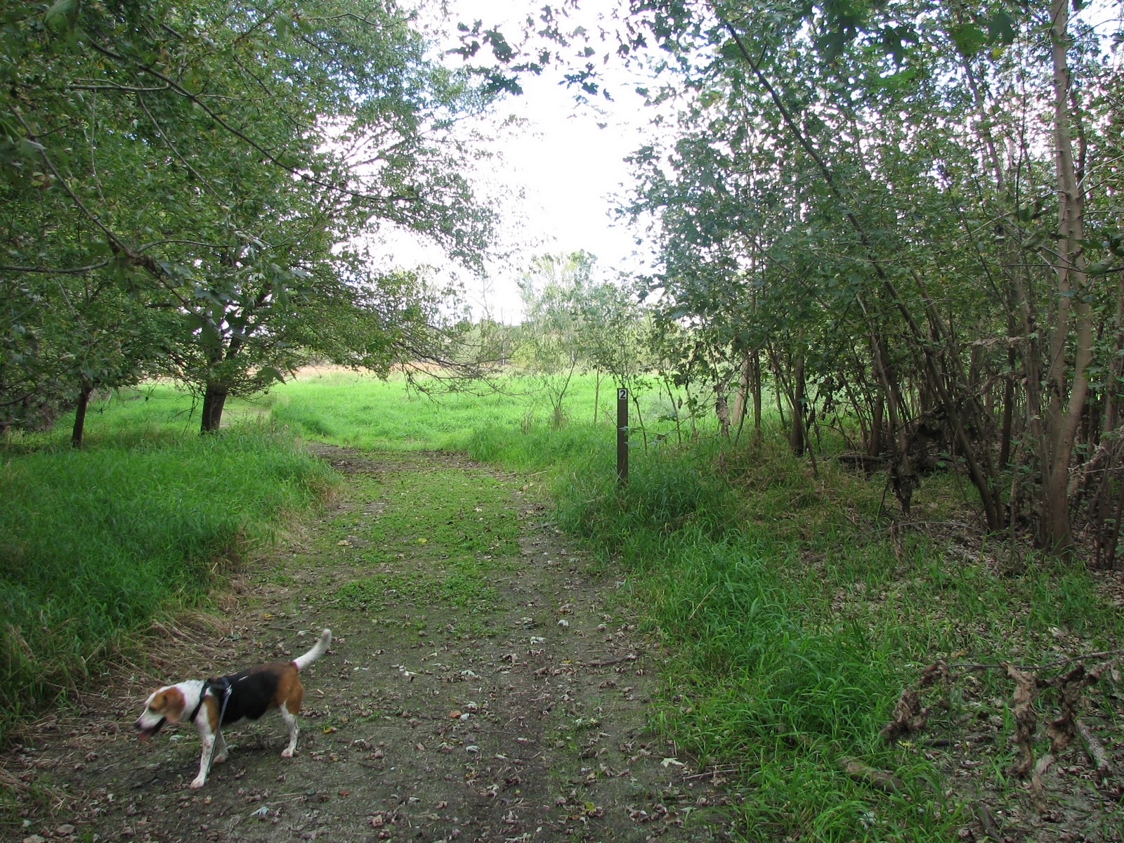
Just after marker 4, the trail leaves the wooded area and enters an open field again.
 The trail just ends here at this gate that was locked. That is Blair Road on the other side of the gate.
 This is the field looking east from the trail near the gate. There is what appears to be the remnants of a trail, but no trail. There were a fair number of home made trails so we bush whacked it to the east across the field to see what we could see.
 We got to this body of water and Wilma finally got to play in the water. It was pretty muddy and not all that great as far as she was concerned. But she got a drink anyway.

This is after we started backtracking. We walked over this coming in as well. It is some kind of concrete structure near marker 4. Not sure what it is for. It kind of looks like part of an old driveway. 
We continue along water control berm.  
 We find access to the water, but lots of mud. The mud does not deter the creek beagle.

 Continuing on we come across a fork in the trail. A little white dog appears on the trail. He runs back up the trail, and soon returns with his two humans. An older couple who tell me about having to climb over the fence to walk along Blair Road. Wilma and I head north to see if we can find marker 6 and then 5. We find 6.

We find more water access. Muddy, but access. Wilma scared up a bunch of good sized frogs here. Must have been a couple dozen of them that took off from sunning themselves on the bank when she went down to the water. We also saw geese and ducks in this area as well as other water birds I could not ID.
The trail just stops at the road again, with another locked gate. It never makes it to marker 5.
We back track and head to the parking lot. Mostly along the snow mobile trail.

[update 9-29-10]
I got an email back from the FPD this morning saying they are going to update the trail map, put up signs indicating the trail dead ends at the road, and  make some kind of access at the road that does not require climbing over the gate. Can't ask for more than that.

Saturday, September 25, 2010

Deer Run Forest Preserve

My original plan was for a 5 or 6 mile hike at a forest preserve to the west of Rockford, but a weather front was rolling in from the west so that seemed like a mediocre idea so we went to Deer Run Forest Preserve to the south and east of Rockford.

We ended up walking about two and a half miles in an hour and 20 minutes. I flirted with the idea of walking on all three of the loops shown on the trail map, which would have been 5 or 6 miles, but the weather front that appeared to be coming in convinced me otherwise. It didn't rain on us, and as of 6pm it has not rained where I live, so I might have been OK, but I live quite a distance to the north (15 miles or so) of the FP where we hiked, and the rain seemed to be going to the south of where I live.

I wore my new ICW boots. They are heavy but I found them pretty comfy and they have some ankle support.

I initially was planning to start on the trail near the entrance on River Road but despite a sign that said "open", there was a chain across the entrance to the trail, so we drove down to the other parking lot and started the hike from there.

Lots of water, but no bugs. Maybe the coolness discouraged them - it was in the upper 50's.


These signs are at the trail head.

The trail is mostly a mowed path through the weed fields, but there is also some wooded areas that it passes through. Lots of wild flowers. We also saw some geese, what I think was a blue heron, and a lot of other birds I could not identify.


 Milk weed.
 A trail map on the trail that has a "You are here" arrow that is a half a mile off. I sent the FP district an email about it.

 Some interesting yellow fungus growing on a tree.

The trail runs along the river and/or creeks for much of its length, but the banks are pretty steep and there is not much in the way of access to the water.  I might have been able to get to the water if I really had to, but I could see little gullys, and small hills of dirt, holes, and mud. I really did not want a broken ankle.

 Seeing these sand bars I thought maybe there would be some access, but no luck.

 A couple of places the path widens and is mowed to the river bank. But no access to the water.
 Finally, the horse crossing. Good water access here.
 Wilma goes in for some water and to play a little in the river. Its at least a couple feet deep, so I was not going to try and ford it. Wilma would have had to swim across.


Overall, a pleasant little trek with the creek beagle, even though there was not much water access, despite being within 50 yards of water through much of the hike.

Wilma did investigate some fresh horse droppings she found on the trail. She sniffed them up and then grabbed a mouth full, but dropped it when I yelled at her.

Saturday, September 18, 2010

Blackhawk Springs Forest Preserve Hike With the Beagle

In some respects it was a bit of a disappointment, as  both of the creeks shown on the map were mostly dry, with a few patches of standing water. But the natural spring and the river was enjoyed by the creek beagle. And by me. Despite me managing to get lost. I intended to walk from the Mulford Road entrance parking lot to the grand trail and back, for about a 3 mile hike. I got turned around looking for the creek shown on the map and ended up on the small loop which added about a mile. By the time I realized I was not where I really wanted to be, I figured what the heck. Might as well just finish it out. Then we did an extra small loop in the NW corner of the park just to see what was there. We stopped for some play time. The hike ended up being about 2:15 long.

Very muggy, about 70 degrees F. I drank most of the 2 quarts of water in the water bladder (Wilma got a little of it). Pretty buggy as well.

This is the bridge over the creek shown on the trail map near the parking lot. The creek was mostly dry here, with a few patches of standing water. There never was real good access to it anyway, and with no running water to speak of was not worth even trying to get to it.

You have to walk on the bike trail a couple hundred yards to get to the grand trail. It's a nice bike path. many of the trails are just mowed paths through the fields of weeds, like this one that comes in to the bike path near the bridge.
This is the trail down to the springs. Its well marked and is part of the grand trail.
It's mostly a down hill grade until you get to the springs, along the dry creek bed. This is fairly typical of the paths through the wooded areas. A little rough, muddy, and uneven, with lots of elevation changes, but nothing real difficult.
This is the natural spring. When we walked up I saw some kind of water critter (maybe a frog of some sort) scoot off underwater.
Wilma liked the springs. I could see water bubbling up from underground.

We followed the trail until we found a place to get to the river. Wilma went to check out the river and sank down to her knees in the muck. being a hearty beagle, she was not fazed at all by the mud.
A little farther down the path we found a spot more to her liking.
This is the north end of the big island shown on the trail map. Not shown are some canoing kids who were on the island out having some fun.
The mowed grass is typical of the path along this part of the trail. We find another spot for Wilma to check out the river. And rinse the mud off her paws.
Mussels I guess. There were quite a few of these shells on the banks here.
More of the shore line. The bridge in the background is for the bike trail. I had seen a large wading bird of some kind on the island in the background, but could not get to an advantageous spot to get his picture before he left.

View from the bike path bridge looking down stream (north).
A marker for the petroleum pipeline.
Not a great picture. I think the trail may have gone into the woods forward from here but was changed to go to the left for some reason. We followed the trail into the woods maybe 100 yards or so, and then went back to the main trail as it got a bit overgrown.

Some plant with a pod of red berries on it on the side trail. I saw a lot of these back there. Not sure what they are.

Marker 3. I think the side trail we saw a bit earlier comes out here.

The path going west from marker 3 is pretty much like this the whole way. Houses to the right (north) and a path mowed through the weeds.
We run across a toad on the trail. Wilma gave him a sniff, but was otherwise not real interested.
A field of prairie sun flowers.
Back to marker three after getting on the 1 mile loop while trying to find the creek that was all dried up.
A bad picture of marker 4.