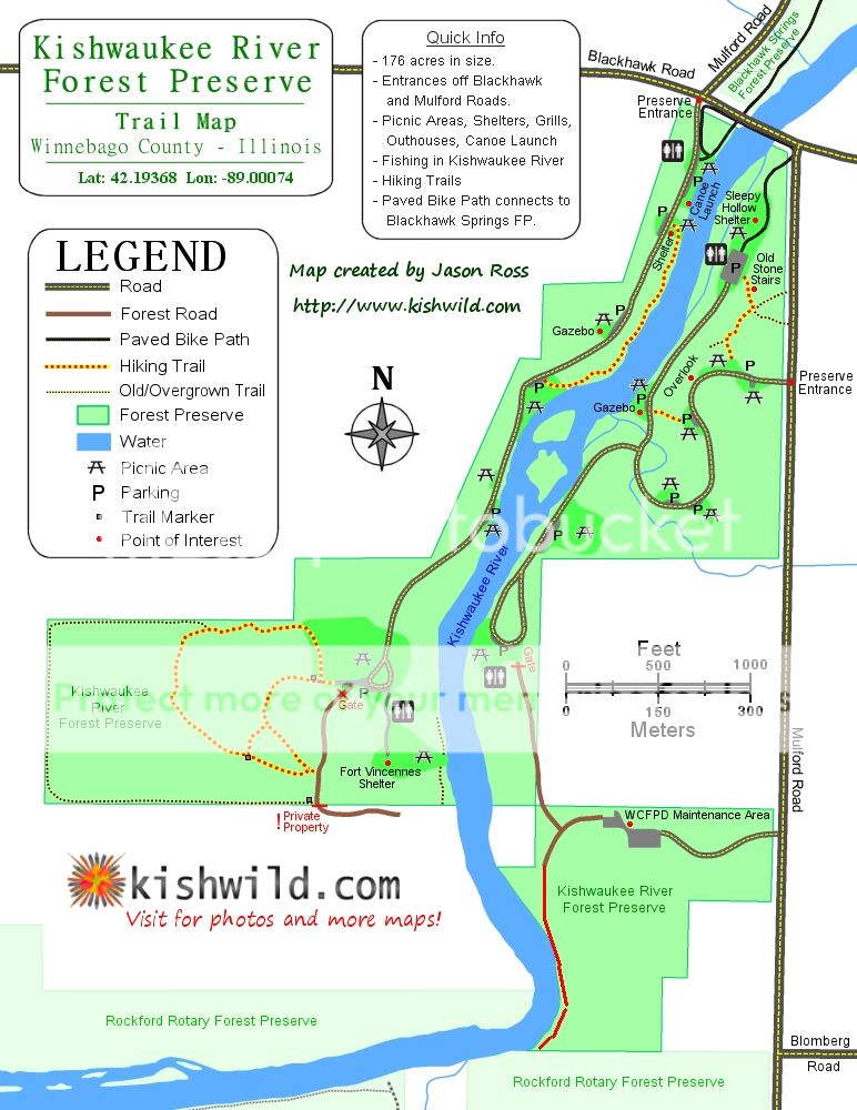
It turns out that it is actually pretty nice and the map just does not do it justice. I found a map on Kishwild.com that shows more trails than the district's map.
We parked near the entrance at Mulford and Blackhawk and proceeded south along the river. We continued south along the park road to the baseball diamond near the Ft. Vincennes shelter. There is a gate nearby that says "Private Drive". We turned east here to catch the trail shown on the district map.
I noticed other people walking down the "Private Drive". It is within the preserve. I don't know why it is labeled "private". But we took the trail through the forest and then down to the same drive to the end where it dead ends into a gate that really is private property.
The Kishwild map shows a trail that starts here and basically goes along the perimeter of this section of the park. Its a nice hike, much longer than the shorter trails shown on the district map, although they are probably nice too. We skipped them in favor of the longer trail along the perimeter as suggested by a couple of hikers we came across.
We got back to the baseball diamond and back tracked along the park road back to the main entrance, and used the bike path bridge to get to the other side of the river.
Then we walked along the park road back to what is called the maintenance trail on the district map. It is shown but not labeled that way on the Kishwild map. This trail is a dirt and gravel road that parallels the river until it dead ends into a gravel road. The road can go west toward the river or east toward the district's area maintenance facility. We headed west toward the river. Neither map shows it but there is a trail that continues along the river all the way to a creek. We crossed the creek (more of a ditch really) and continued along the river as it turned west (I think technically this area is part of Rotary FP). We went to the boundary marker, and then poked around some to the south before heading back the way we came.
We saw a lot more people than I would have expected. Lots of people on the bike path, and lots of people out fishing and walking. It was a nice day so I was not real surprised about that.
Sorry about the wind noise.
No comments:
Post a Comment